The Plomosa Property consists of land administered by the Bureau of Land Management (BLM) in the historical Plomosa Mining District. The history of mining in the lower Colorado River country of southwest Arizona extends back to the times of the early Spaniards. When the Americans first came to this country they found many old mines and prospect pits. Evidence of much earlier mining activity was found in the Plomosa Mountains, which hosts the Plomosa Mining District.
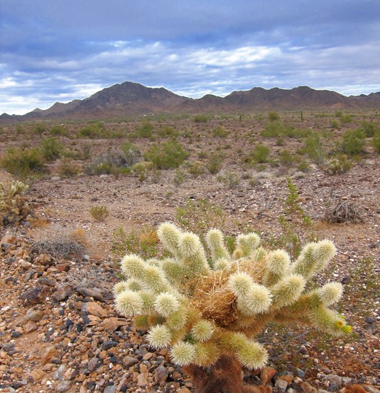
The original Plomosa placers occur on the west side of the Plomosa Mountains in and near Plomosa Wash. Gold-bearing gravels occur in a belt about four miles long along the western edge of the mountains. The source rock for this placer gold is a massive formation of meta-sedimentary rock which runs for many miles along the western flank of the Plomosa Mountains.
Placer and lode gold was first recovered from the Plomosa Mining District in the 1860's by small-scale shallow placer and underground mining operations, and later by larger-scale operations. Accurate production records are not available; however, historical records state the gold content of placer gravel was up to several dollars per cubic yard at a time when gold was valued at around $21 per ounce. The gold grade computed from this data is equivalent to 0.10 to 0.14 ounces gold per cubic yard of placer gravel.
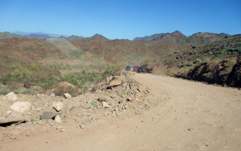
Access to the property is via well-maintained asphalt and dirt roads from Interstate 10 at the town of Quartzsite. The total size claims is 1100 acres.
I. EXECUTIVE SUMMARY
The PLOMOSA PLACERS Project It is currently seeking funding in the amount of $50,000,000 in one draw to begin extraction and processing of its gold and black sands materials. One of its claim holdings is known as the "LOMOSA PLACERS Placer Project." This project is a placer mining endeavor only, focusing initially on gold, but then pursuing other metals and minerals found in the black sands.
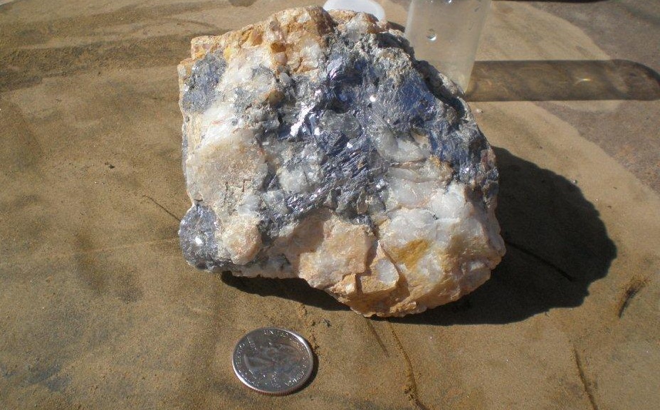
The PLOMOSA PLACERS Project is located, just off of Highway 10 and Highway 95 in the town of Quartzsite, and is surrounded by small and large scale mining operations. The alluvial placer gravels consist of schist, granite, and volcanic rocks derived from the Plomosa Mountains east of the group of claims. Some of the gravels are cemented locally by caliche. The schist exposures in the mountains contain gold-bearing quartz veins and stringers, and are most likely the original source of the placer gold deposits. The schist?s are geologically important because they are the host rocks of numerous prolific vein-controlled gold mines in Arizona.
Geologic evaluations show the placer gravels are from 30''- 90'' feet in depth and average 80'' in depth.
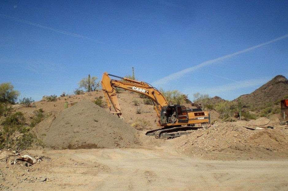
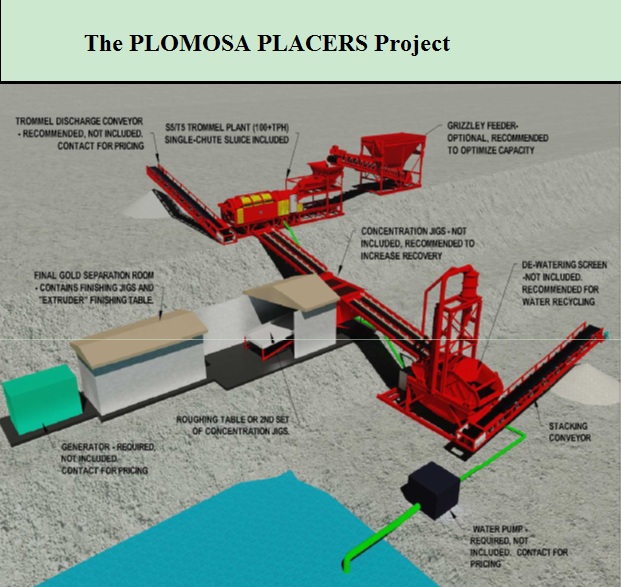
PLOMOSA PLACERS is preparing to setup a pilot plant to begin testing the claims for production. The pilot plant will consist of a scrubber, impact mill, backhoe, wheel loader, Golden Boy trammel and a Falcon Concentrator capable of running 1000 yards per hour, with trenching and sampling every 250''-300''n the main gold bearing gravels. An onsite senior geologist, Craig Parkinson, who is accepted by the U.S. and the Canadian Stock Exchange, will oversee the operation to re-certify the gold values present in the gravel.
It is PLOMOSA PLACERS intention to expand the gold recovery operation to process a minimum of 1000 yards an hour in Phase 1, working a 10 hour days, 5 days per week. When PLOMOSA PLACERS Placer LLC expands to Phase 2, we will build a second plant to process an additional 1000 yards per hour.